The Cartographic Approach and Its Role in Developing Health Tourism: Examples from the Atlantic Region and Oases in the Kingdom of Morocco


The Cartographic Approach and Its Role in Developing Health Tourism: Examples from the Atlantic Region and Oases in the Kingdom of Morocco
Prepared by:
- Oumaima Oubalouch: Master’s in Tourism Communication and Heritage Valorization, Moulay Ismail University, Polydisciplinary Faculty of Errachidia, Morocco.
- Email: omaymaoubalouch@gmail.com
- Ahmed Abdelmounaim El Yazidi: Master’s in Tourism Communication and Heritage Valorization, Moulay Ismail University, Polydisciplinary Faculty of Errachidia, Morocco.
- Email: ahmedabdelmounaimelyazidi@gmail.com
General Introduction
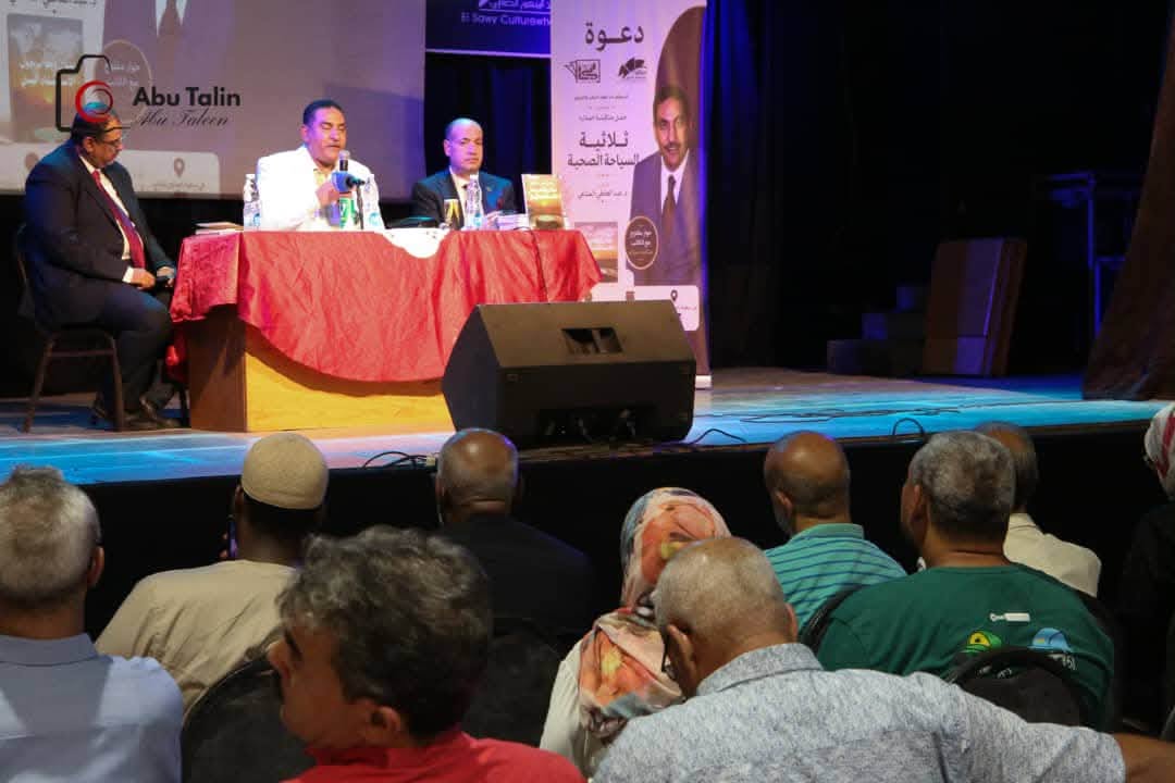
First and foremost, we extend our deepest gratitude to Dr. Abdelati El Manaoui for his valuable lectures delivered to Master's students at the Polydisciplinary Faculty of Moulay Ismail University in Errachidia, Kingdom of Morocco. These lectures and scientific discussions are part of the ongoing academic cooperation between him and the Polydisciplinary Faculty, coordinated through fruitful communication with the esteemed Professor Dr. Reda El Chalfi, coordinator of the Tourism Communication and Heritage Valorization Master's program at the same faculty. We also thank the pedagogical, administrative, and technical staff, as well as the partners of the Health Tourism Faculty, for this joint bilateral effort that strengthens scientific and academic ties to advance purposeful scientific partnerships.
The map, therefore, serves as the visual and mental driver of tourism activity. It is not merely a tool for navigation, but an integrated marketing and planning instrument that transforms geographical sites into attractive destinations. Through a cartographic lens, the spatial environment is simplified for the tourist, giving them the confidence to explore landmarks and experience new itineraries. Digital and interactive maps also play a crucial role in linking essential services to tourist hotspots, thereby extending the length of stay and supporting the local economy. Consequently, the map remains the bridge connecting the tourist's desire for exploration with the efficient, sustainable management and development of a tourist destination.
The cartographic approach is a decisive tool for understanding the role of the "Atlas and Oases" region in building and developing health tourism. It does not stop at displaying spatial data; rather, it reveals the underlying logic behind the distribution of natural resources and elements suitable for natural therapy within the region. Reading the map reveals that this territory—stretching across Ouarzazate, Tinghir, and Errachidia—is built upon a clear ecological gradient that merges mountains and oases, forming the structural baseline for a multi-dimensional health tourism sector.
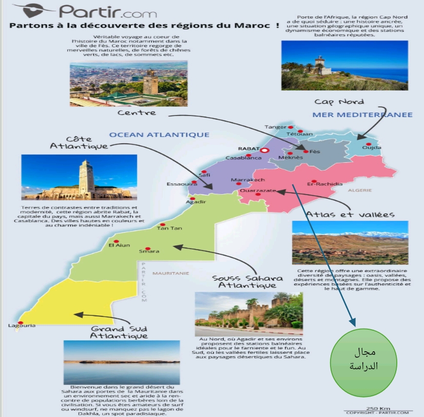
- Map 1: Tourism Regionalization of Morocco Based on the Potential of Each Zone (Independent of the Advanced Regionalization Administrative Division)
- This site is characterized by specific features, most notably the scarcity of vital natural resources such as water...
- Map 2: Provinces Comprising the Region
- Source: https://www.academia.edu
Administrative Boundaries:
- Fez-Meknes Region and Beni Mellal-Khénifra Region to the North.
- Marrakesh-Safi Region and Beni Mellal-Khénifra Region to the North.
- The Oriental Region (Eastern Region).
- Souss-Massa Region to the West.
- Algeria to the East and South.
Errachidia
Formerly known as Ksar Es-Souk, Errachidia is a predominantly rural province, and it is the largest province by surface area within the Drâa-Tafilalet region. This city is renowned for its cultural identity, which reflects the architectural and urban heritage of the past. This heritage consists of historical monuments such as Sijilmassa and the Mausoleum of Moulay Ali Cherif, alongside several ksour (fortified villages) like Ksar El Faida, Ksar Oulad Abdelhalim, Ksar Abou Am, Maadid, and Ksar El Meski.
Midelt
Midelt is a Moroccan city located at the junction of the Middle Atlas and the Eastern High Atlas mountain ranges, with a population of approximately 60,000 inhabitants. Situated at an altitude of 1,521 meters in the Atlas Mountains, Midelt features a mountainous climate often characterized by winter snowfall at this elevation. Mountain vegetation (such as conifers and cedar trees) largely replaces Mediterranean vegetation (like oak and olive trees) alongside other plant life.
Tinghir
Tinghir, or Tinghir in Tamazight, has been the capital of the Tinghir Province since 2009; previously, this city was part of the Ouarzazate Province. Its name originates from the Tamazight word Tin (place of) and Ighri (shoulder or ridge of a mountain). It is an exceptional site for rock climbers, featuring rock faces up to 300 meters high that are very well-equipped, though many remain unexploited.
Ouarzazate
Ouarzazate is a city located south of Morocco's High Atlas Mountains, famously known as the gateway to the Sahara Desert. The massive Taourirt Kasbah, which houses a 19th-century palace, offers a commanding view of the surrounding rocky landscape, which has been featured in numerous films. To the northwest lies the earthen, red-walled fortified village of Aït Benhaddou, while the rugged Todra Gorge extends to the northeast. The route of the southeastern winds flows across the fertile palm groves of the Drâa Valley toward the desert.
Zagora
Zagora is a Moroccan city located within the Drâa-Tafilalet region in southern Morocco. In addition to its proximity to the desert, it is characterized by stunning natural landscapes that beautifully reflect on its buildings. The city of Zagora spans a total area of 2,180,307 hectares, bordered to the north by Ouarzazate Province, to the east by Errachidia Province, to the southwest by the city of Tata, and to the southeast by the Algerian-Moroccan border. It has a population of around 65,000 inhabitants.
- Source: Monograph of the Drâa-Tafilalet Region (Regional Monograph – Drâa-Tafilalet).
- Map 3: Tourist Tour Routes in Errachidia
- Source: CPT Errachidia
The map clearly illustrates the structural relationship between mountainous highlands and the foothills' oases. The mountains serve as an environment that generates ecological comfort elements—particularly fresh air and a temperate climate—whereas the oases represent spaces for settlement and recreation due to the availability of water and vegetative cover. From a health tourism perspective, this spatial distribution allows for functional integration between natural therapy areas tied to the mountain climate and areas for relaxation and psychological healing within the oases. Hence, the cartographic approach helps map out "therapeutic zones" within the province and link them to a network of centers capable of hosting tourists and providing services.
Furthermore, the map reveals the concentration of population centers within oasis basins such as Erfoud, Rissani, and Goulmima. This reflects the availability of conditions necessary for life and settlement, which consequently allows for the development of a tourism infrastructure based on accommodation, as well as traditional and modern health services. Conversely, mountainous regions and semi-arid zones appear as less densely populated areas, yet they possess significant therapeutic potential—especially regarding air purity and natural tranquility—making them well-suited for activities like therapeutic walking and meditation.
This is supported by infrastructure including hotels, restaurants, campsites, airports, tourist lodges, ecological zones, as well as primary and secondary roads designed to break the isolation between urban, rural, mountainous, and border regions.
From a tourism planning perspective, cartographic analysis makes it possible to identify the connectivity axes linking these units. This is a fundamental element in health tourism, which relies on the visitor moving between multiple therapeutic spaces as part of an integrated experience. For instance, an axis connecting Ouarzazate, Tinghir, and Errachidia could form a "health trail" combining mountain and oasis therapies, granting tourists a progressive experience that blends physical activity with deep relaxation. This connectivity also enhances the synergy of the tourism offering and reduces the spatial isolation of certain sites.
The importance of the cartographic approach is also highlighted by its ability to uncover spatial disparities that could impact the success of health tourism projects, such as uneven water distribution or weak infrastructure in certain zones. Although health tourism depends heavily on natural resources, it requires a minimum baseline of facilities and services. This necessitates directing investments toward areas with the highest potential for exploitation without disrupting the ecological balance. In this regard, the map serves as a decision-making tool by identifying priority areas and preventing environmental pressure on fragile oasis systems.
Moreover, the cartographic lens highlights the network-oriented nature of the Atlas and Oases region. Each oasis or mountain site is not understood in isolation, but rather as part of an interconnected ecosystem that can be leveraged to build a comprehensive health tourism product. This network approach allows roles to be distributed among various spatial units; some areas specialize in natural therapies, others in accommodation, and others in services, which boosts economic efficiency and ensures resource sustainability.
In light of this, it is evident that the role of the cartographic approach in health tourism goes beyond mere diagnosis; it extends to planning and guidance. It offers a precise understanding of spatial relationships and helps build a strategic vision rooted in mountain-oasis synergy, maximizing the unique ecological and cultural traits of each territorial unit. Thus, this approach establishes a scientific and methodological framework for developing sustainable health tourism in the Atlas and Oases region, capable of balancing economic growth with natural resource preservation.
Relationship Between the Region's Climate and Creating a Favorable Environment for Health Tourism (Rainfall Case Study)
- Source: https://www.academia.edu
- Analysis: The climate here appears semi-arid, which is suitable for establishing health tourism that relies on ecological specificities, linking the climate with other natural elements such as humidity and air quality.
Hydrographic (Water) Network Map of the Region
- Source: https://www.academia.edu
- Analysis: The watercourses are predominantly seasonal (intermittent flow), which historically prompted oasis inhabitants to resort to ingenious engineering methods to utilize and manage water, such as khettaras (underground aqueducts) and a highly precise irrigation system tailored to the seasons and water availability.
Through the analysis of this map, engineers and geologists can:
- Predict Spring Locations: By tracing the intersection points of major faults with limestone layers.
- Determine Mineral Characteristics: The rock type (e.g., ancient volcanic or sedimentary rocks) determines the type of minerals dissolved in the spring (sulfur, sodium, calcium), which gives the hot springs in the region their therapeutic value.
Conclusion
The cartographic approach constitutes an essential analytical and strategic tool for understanding and developing health tourism. Its role goes beyond geographical description to interpret the distribution of natural resources and determine the potential for tourism exploitation within the territory. Applying this approach to the Atlas and Oases zone in the Drâa-Tafilalet region demonstrates that this space features an integrated spatial structure merging mountain highlands and oases. This enables a diversity of health offerings, ranging from natural therapies linked to mountain climates to relaxation within oasis environments.
Cartographic analysis also reveals disparities in population and infrastructure distribution. Stabilization and services are concentrated within oasis basins, contrasting with mountainous and semi-arid zones that feature low density but are rich in therapeutic environmental potential. This distribution facilitates the creation of an integrated tourism network by linking different spatial units via road axes, allowing the design of diverse health itineraries that enhance the region's appeal.
Furthermore, maps emphasize the importance of natural resources—particularly climate and water networks—in supporting this type of tourism, despite challenges related to water scarcity and irregularity. It also enables investments to be directed toward the areas most viable for development, while respecting environmental balance and protecting fragile ecosystems.
Based on this, it is clear that the cartographic approach represents an indispensable methodological framework for decision-making in health tourism. By providing a holistic vision built on spatial synergy, it contributes to achieving sustainable tourism development that pairs economic growth with the preservation of natural resources.
References
- Monograph of the Drâa-Tafilalet Region.
- Regional Office for Agricultural Investment (ORMVA) of the Drâa-Tafilalet Region.
- Provincial Delegation of Tourism, Errachidia.
- Guir-Ziz-Rheris Hydraulic Basin Agency.
- https://www.academia.edu
- Personal work using GIS (Geographic Information Systems).